|
| Home | Mapping Services | Photogrammetry | About Us | Technical info | For Sale | Clients | Contact us |
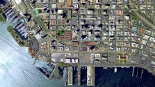
About San-LoSan-Lo Aerial Surveys specializes in large format mapping. Map scales of 1”=20’ to 1”=40’ comprise 99% of our total output dating back to 1968. We also produce Digital Orthophotography, usually at the same photo scale used to generate the maps. The range of production includes line work, DTM information, rectified and geo-referenced photography and soft-copy work. 25 Years ExperienceAt San-Lo we always use the best input to produce the claimed result. Our employees are extremely experienced and understand our principals of quality. Our photogrammetric staff have an average of over 25 years experience compiling maps. Because of our high degree of accuracy combined with speedy and affordable service, many San-Lo clients have been customers for 15 years and more.
|
| San-Lo Aerial Surveys, 1130 D Street, Suite 7, Ramona, CA 92065-0543 Tel: 858-565-1024 Email: 460san-lo@san-lo.com 460san-lo@san-lo.com |
 Steve Shelton